
Revised August 3, 2022
Spruce Knob Mountain Center
18 Woodlands Way
Circleville, WV 26804
Phone: 304-606-3233
email: info@experience-learning.org
web: https://experience-learning.org
AHSP Site Layout Map (pdf) is a schematic showing the observing fields and other AHSP resources at SKMC – Updated
Approaches to SKMC for AHSP attendees – A Last Leg Directions Map (pdf) that provides details of the road approaches to SKMC emphasizing the road directions up the mountain and into the SKMC site. Print a copy, because you will be losing cell-based location service as you reach this part of the trip. Very nice work originally prepared by Ed Takken. – Updated
For more details the directions below are provided in two parts: The first portion covers whatever approach you take up to Judy Gap and the second covers you from Judy gap up the facility off Sawmill Rd. however your first approach.
We have consolidated the Local Maps and Resources page (last Toggle) into this one as well so it’s a lot easier to get ready for the event.
This is the all-around preferred route and directions:
- Follow I-95 South to Washington, D.C., and take the Beltway (I-495) West around the city. Get on I-66 West and proceed to I-81.
- Follow I-81 South to the exit for Route 55/48 West (about three miles).
- Take 55/48 across the WV line, through the town of Wardensville. Wardensville continues to be a notorious speed trap. Drive safely, mind the sudden speed limit change, and consider spending your money elsewhere.
- At the far end of Wardensville, 55/48 becomes the Corridor H divided highway (still 55/48). Take the Moorefield exit (not East Moorefield!) and turn left.
- At the light at the T at the end of the exit ramp at Moorefield, make a left and just stay on Rte. 28 through Moorefield.
- Continue through Petersburg. You’ll make a right turn in “downtown” Petersburg, then go up the hill past a Dairy Queen and on out of town. Note that the closest hospital to SKMC is on your left as you leave town.
- Continue on Route 28 through Seneca Rocks.
- At Judy Gap, after a bridge over the river, turn right to stay on 28 South and follow directions beyond Judy Gap(below).
Note: Google (generated live below or on your own) may show a preferred route that stays on the US 48 divided highway beyond Moorefield, exiting on County 5 and meeting WV 28 west of Petersburg. Google typically recommends it, likely because it is ~2 min. quicker while being 8 miles longer. County 5 is a pleasant 2-lane road through farm land which may be interesting for variety. If you need to stop for a meal or supplies on the way to SKMC, you should definitely follow the route given above through Moorefield and Petersburg.
Also, an alternative route through Harrisonburg, VA keeps you on Interstates for more miles, but involves more sinuous mountain driving on US33 than the route above.
Click to view Larger Map and get customized turn by turn directions for your specific beginning location.
- Follow I-79 into West Virginia and to exit 99 (US Route 33 East) at Weston and Buckhannon.
- Follow Route 33 East through Buckhannon and Elkins.
- Turn right onto Whitmer Rd./Co.Rte. 29, passing into the National Forest backcountry.
- [Rich Mtn. Rd. forms a shortcut from 33 to Whitmer Rd. at Job, WV. It passes over a mountain, instead of sticking to the stream valleys.]
- Turn right onto Dry Fork Rd./Co.Rte. 40.
- Turn left onto Forest Road 916. Continue to its end at Forest Road 112.
- Follow 112 to the left about 1000 ft., then turn right onto Sawmill Run Rd./Co. Rte 28/10.
- SKMC will be on your left.
Click to view Larger Map and get customized turn by turn directions for your specific beginning location.
The turn-by-turn route above the map is much shorter and with gentler grades — but with more driving on good unpaved roads — than the alternative: US 33 past Elkins and Seneca Rocks, and on to Judy Gap where 33 and 28 split, continuing on 28 South to Judy Gap. Print out the Google map for turn-by-turn directions and distances. You WILL lose your digital connectivity along the way.
- Follow I-64 to exit 175 onto US 60 E.
- Follow 60 E through White Sulfur Springs to WV 92 N.
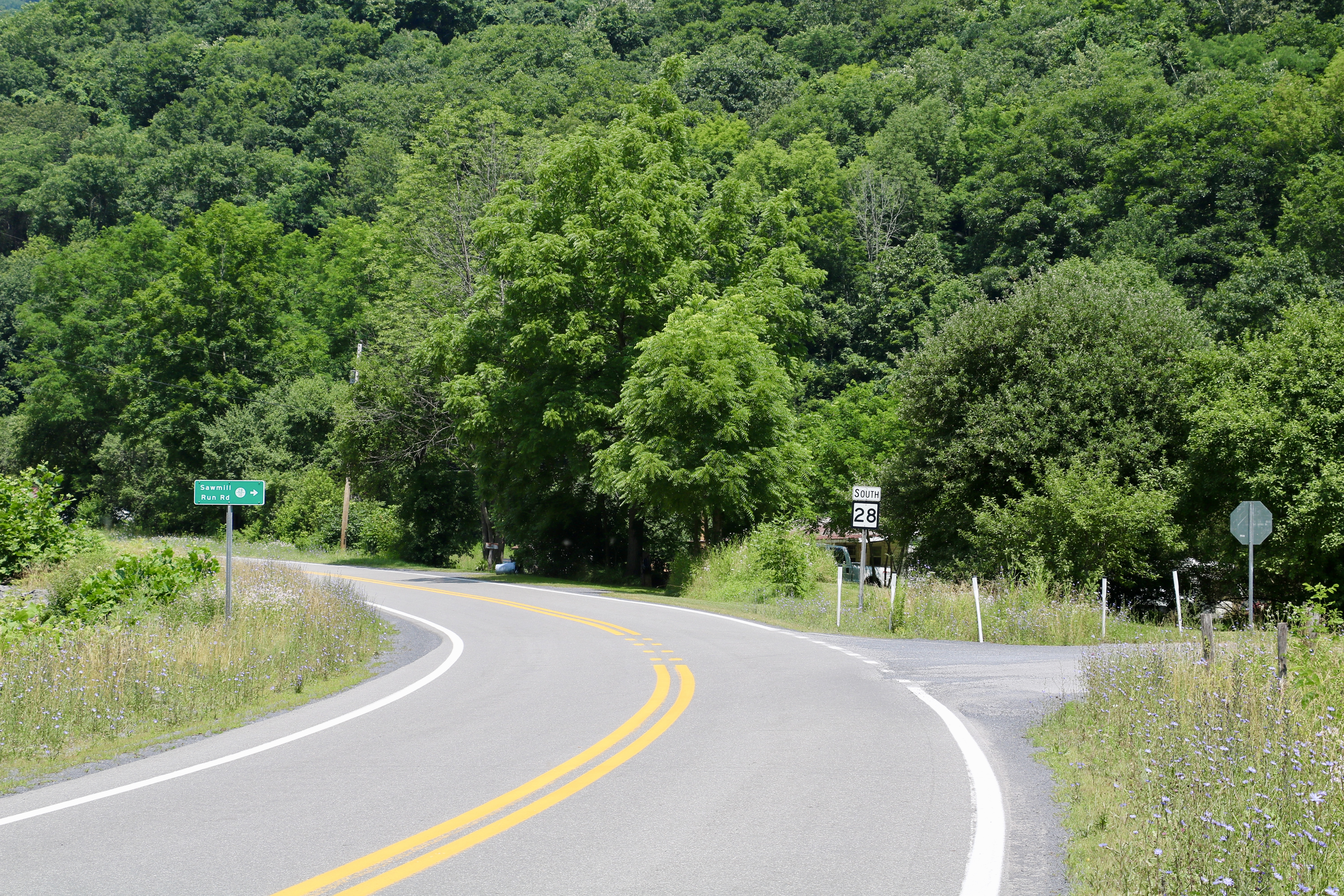
- At Dunmore, turn right onto 28N.
- Turn sharp left on Sawmill Run Road. [If you see the Circleville USPO, you missed it.] Follow the directions below.
Click to view Larger Map and get customized turn by turn directions for your specific beginning location.
- Follow I-64 W to I-81 N to Harrisonburg
- At exit 247, take US 33 W to Judy Gap. This is not a good road through the mountains at the VA/WV line for RVs or trailers. Continue as below.
Click to view Larger Map and get customized turn by turn directions for your specific beginning location.
- Follow Route 28 South through Circleville (3 miles) and Cherry Grove (3 miles).
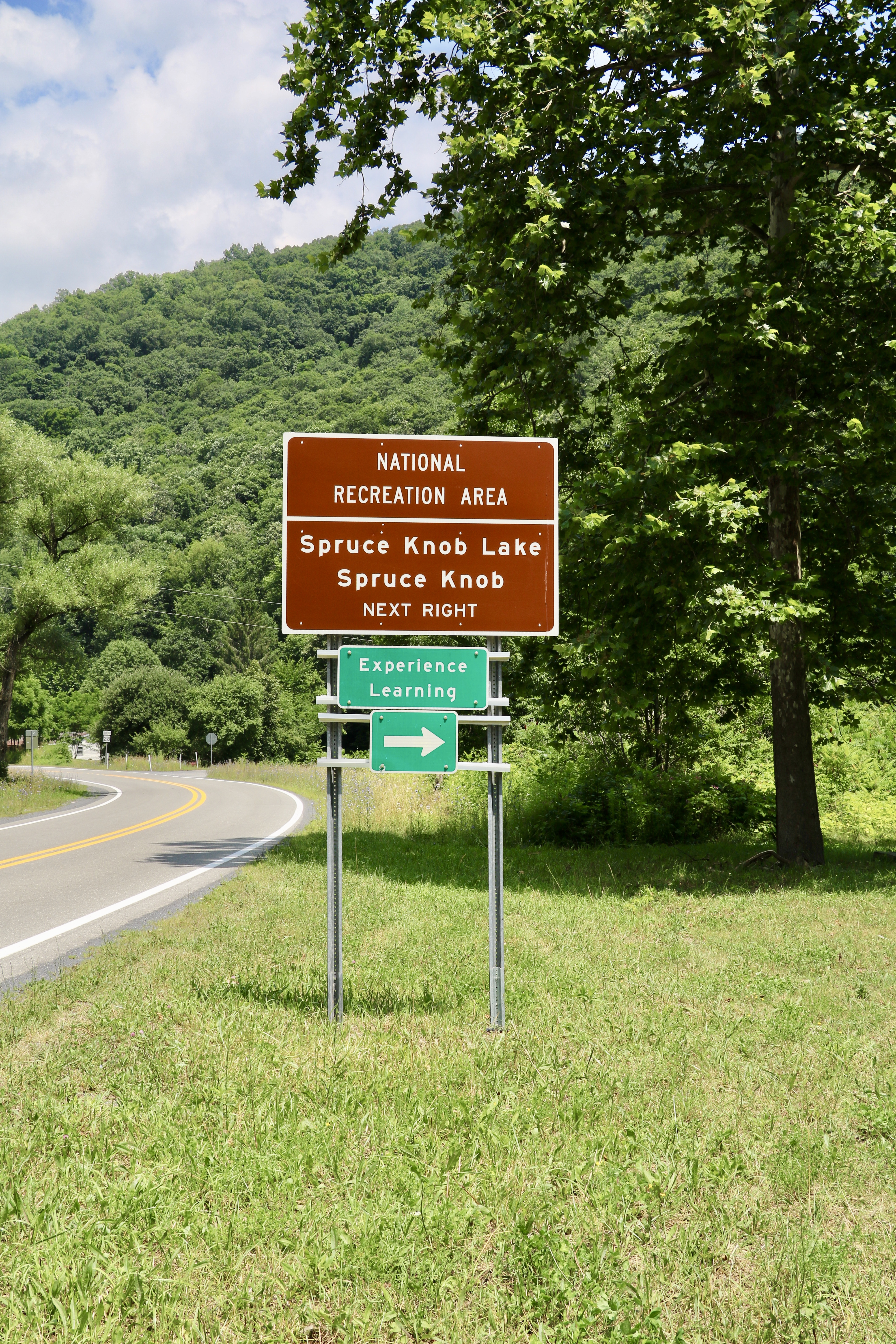
- Approximately 2–3 miles after going through Cherry Grove, turn right on Sawmill Run Road/Co. Rte. 28/10. The turn is marked with a Forest Service sign for Spruce Knob Lake. [Do not take the earlier turnoff for Spruce Knob itself at the Gateway Restaurant.]
- After about 3 miles turn left at a stop sign near a hairpin turn and go another 4 miles to a set of low stone columns and a red farm gate on the right at the top of a hill; if you go down a very long hill and over a bridge at a small creek you have gone too far.
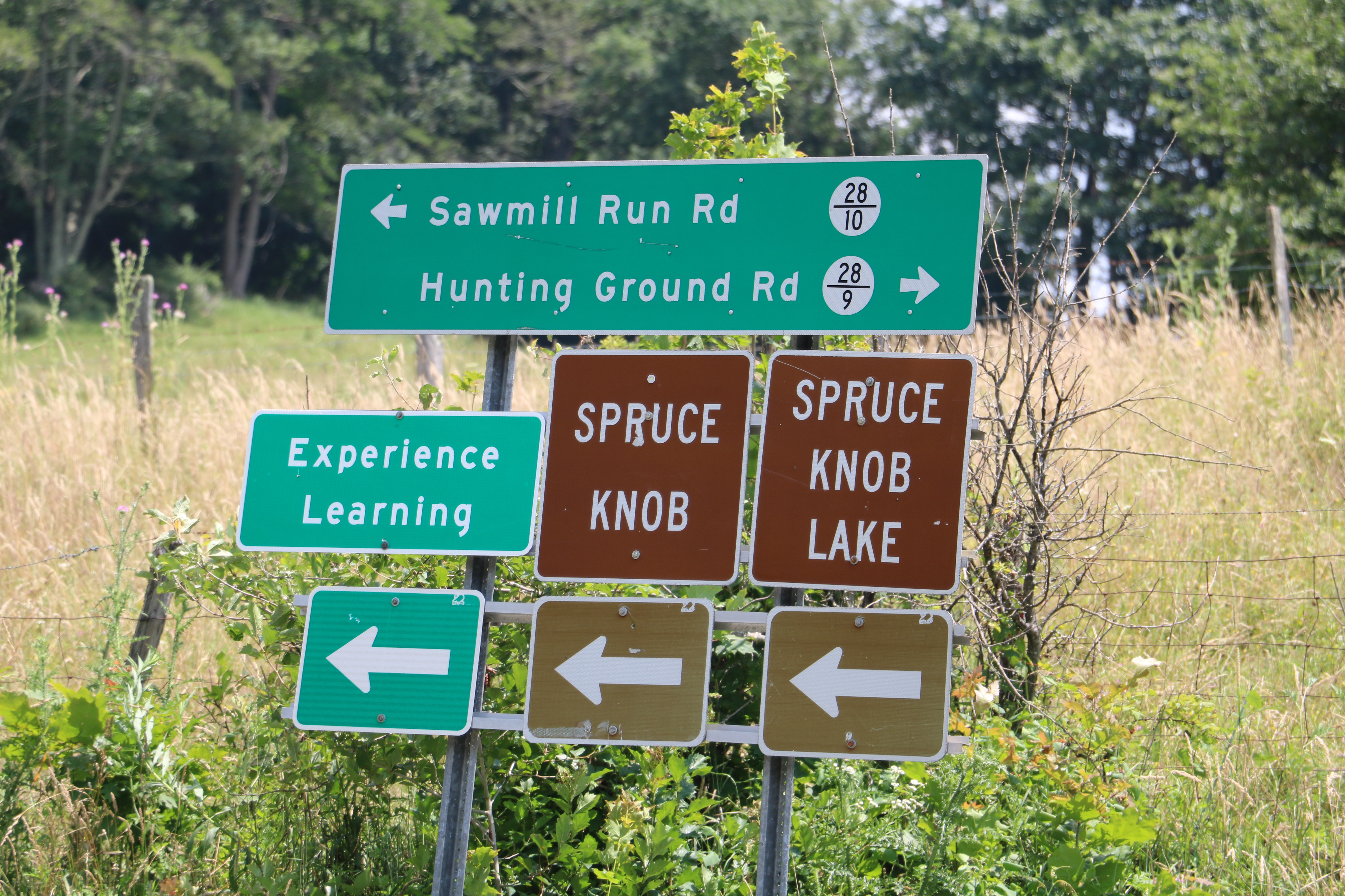
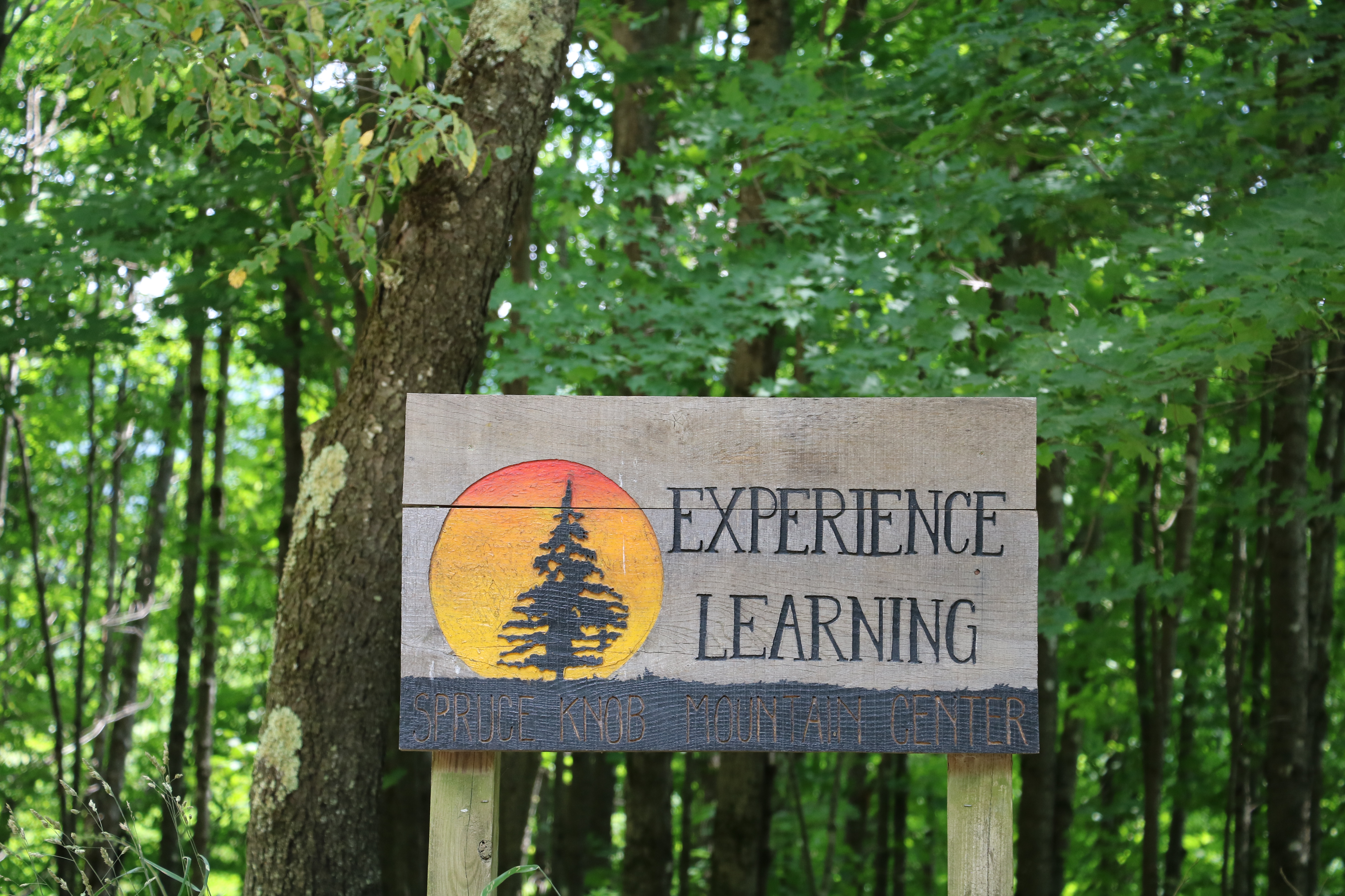
- Turn right through the red gate; marked “Experience Learning.” If you miss this turn and end up at Spruce Knob Lake you have gone too far!!!!
- Bear left, and follow the dirt road 1 mile through farm land until you get to the top of the hill before the large round buildings—yurts. You will see a registration tent for AHSP at the crest on the right side.
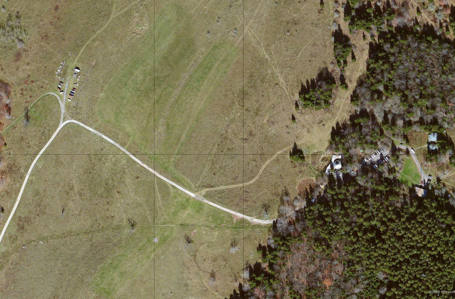
Overhead of AHSP lots SKMC (png)

Panorama from the entrance area towards the Green Lot (jpg)
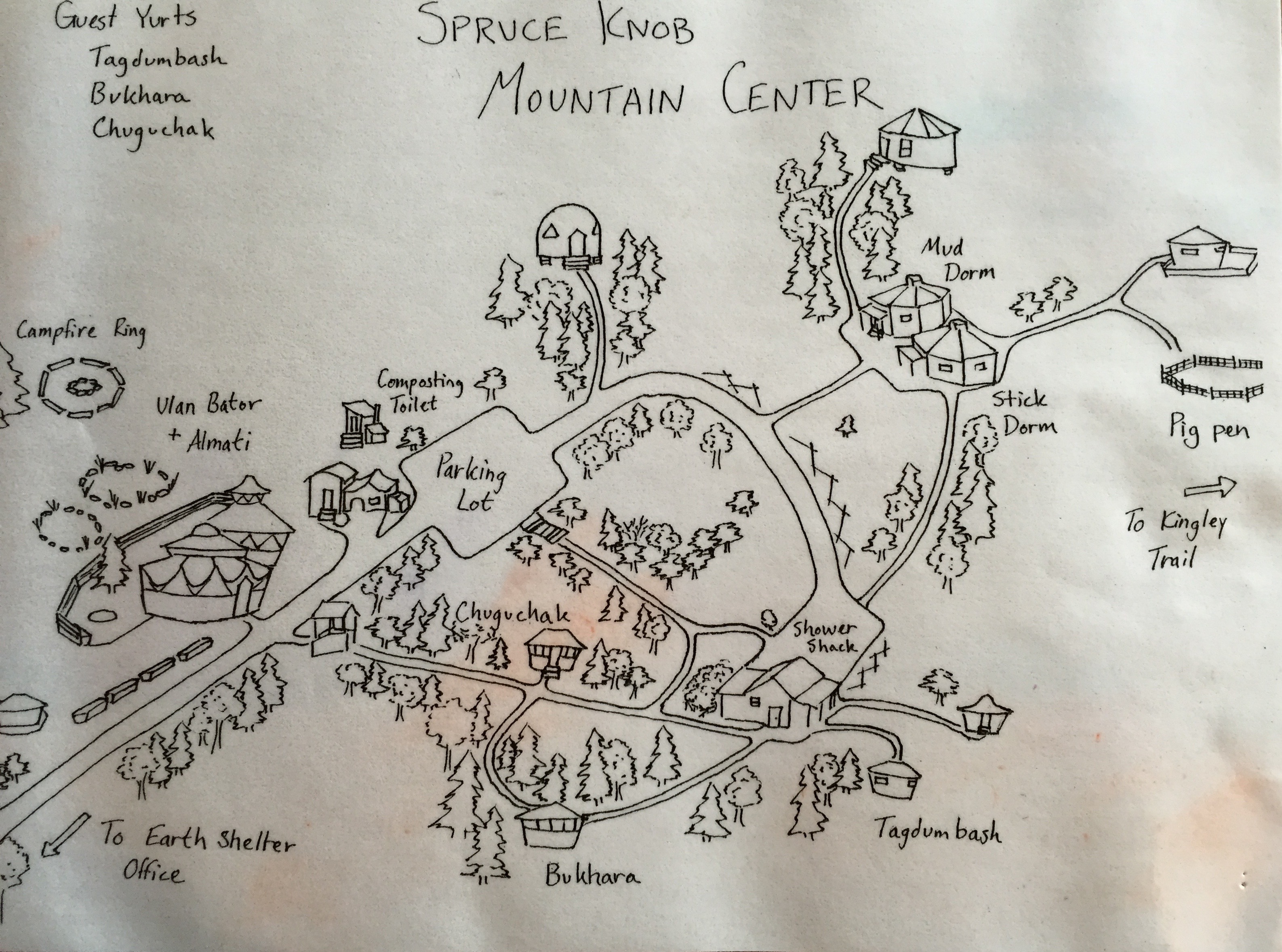
EL – Spruce Knob Mountain Center Layout (jpg)
Other external resources on the area
Monongahela National Forest web page – General information on the park attractions and events
Geologic survey – A detailed geologic information and photos of interesting rock formations
Topographical map of the area